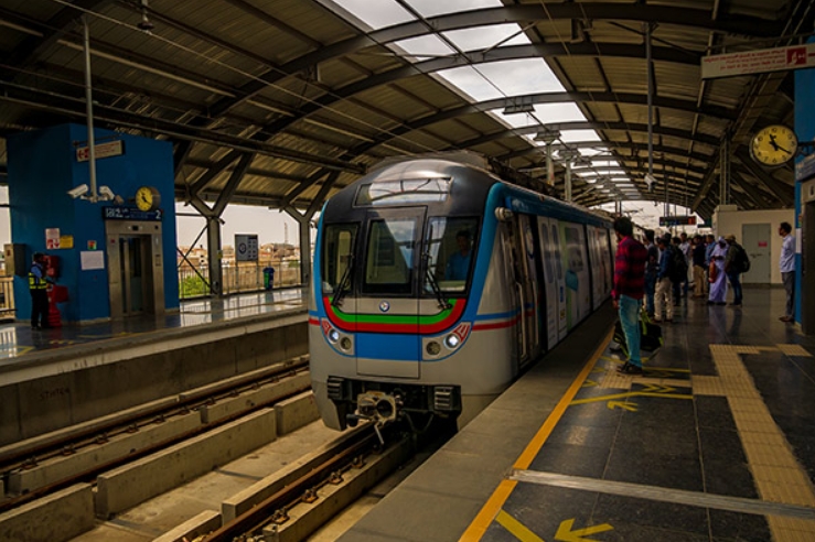
The Hyderabad Metro is a big deal for city travel. It connects different parts of Hyderabad, making it easier and faster to get around. This metro system came about to tackle the city’s heavy traffic and to cut down on long travel times for everyone. With Hyderabad growing fast, the metro is a timely addition, offering a dependable way to move without relying on cars and buses that get stuck in traffic.
The metro stations are modern and the network keeps growing. This isn’t just about more accessible travel — it also helps the environment and boosts the local economy. So, the metro is critical to how the city shapes up in the future, managing its growth and making life easier for its people.
Hyderabad Metro Route Map and Timings
Operational Projects

The Hyderabad Metro runs many routes, starting early in the morning and ending late at night. This helps all kinds of people get where they need to go faster. The metro connects extensive work areas, homes, and relaxing places, making it a vital part of the city’s public transport.
| Operator: | L&T |
| Estimated cost: | Rs 18,114 crore |
| Total stations: | 59 |
| Fare: | Rs 10-60 |
| Timing: | 6 AM to 11 PM |
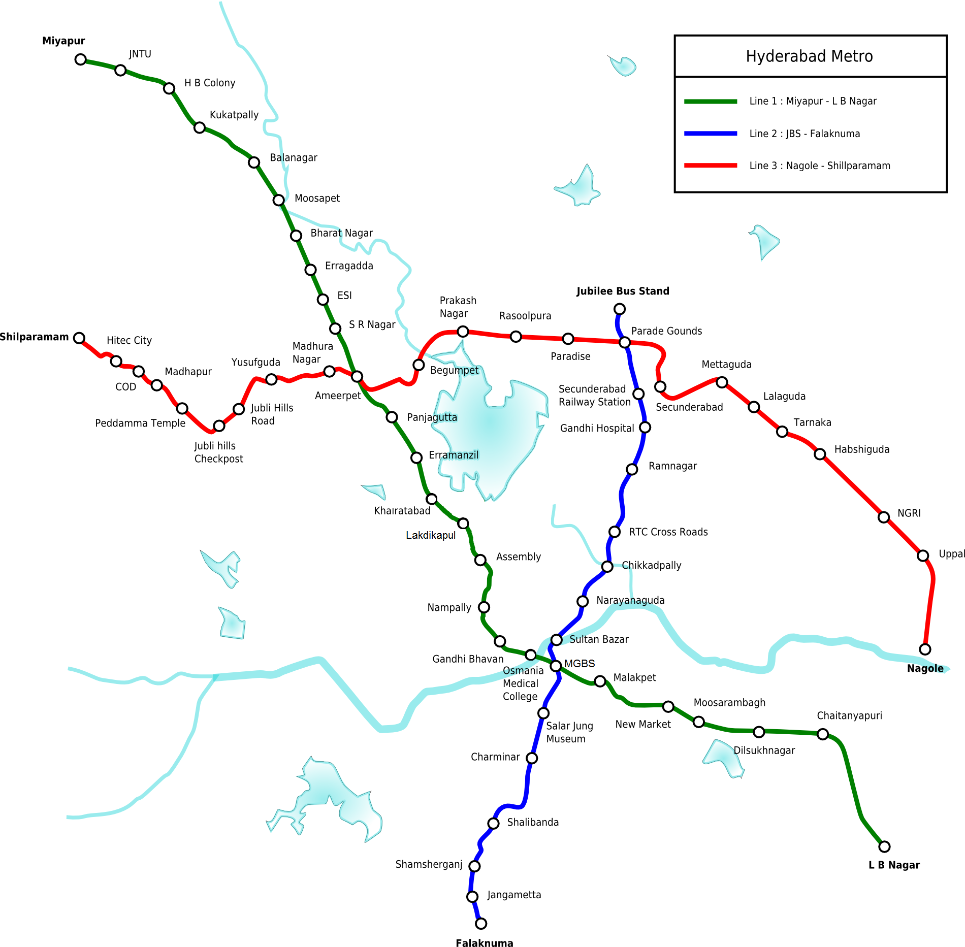
The Red, Blue, and Green lines are all up and running. They cover 69 kilometers and have 57 stops. These lines meet at critical spots, making it easy to switch from one to another and get around Hyderabad more freely. There are plans to grow the network, reaching places that don’t have good transport yet and connecting better with other transport options. This will help everyone move around easier.
You may like this – Kochi Metro Timings: Routes, Schedules, And Fare Information
Hyderabad Metro Lines
Red Line

The Red Line is a central metro line in Hyderabad, running from Miyapur to LB Nagar. It’s about 29 kilometers long and has 27 stations. This line crosses other metro lines at important places, making getting around the city easier.
Key stations include Ameerpet, where you can switch to the Blue Line, and Parade Grounds, which will connect to the Green Line soon. Trains run every 7 minutes during busy times, so you won’t have to wait long. It’s a reliable and quick way to beat the traffic, helping lots of people get where they need to go every day.
Blue Line
The Hyderabad Metro’s Blue Line runs between Nagole and Raidurg, covering a 27-kilometer route. It’s a vital link for getting around the city quickly, primarily through busy commercial and residential spots. Along the way, it stops at significant areas like HITEC City, a big deal for tech and business folks. Also, at Ameerpet, you can switch to the Red Line, making exploring more of the city easier.
This metro line works from the early morning until late at night. Whether you’re commuting daily or just traveling now and then, it fits into everyone’s schedule, helping keep Hyderabad moving smoothly.
Green Line
After the Blue Line, there’s the Green Line in the Hyderabad Metro. It links JBS Parade Ground to MGBS. This line makes it easy to get around the city, connecting major work and living areas. It’s about 9.6 kilometers long and includes seven stations. These stations are set up to help people move smoothly and easily to nearby places.
The Green Line is really helpful for cutting down on traffic and offers a dependable choice instead of driving, especially when it’s hectic. It has crucial stops near government buildings and cultural spots, which is great for people going to work or visiting the city. Plus, it connects with other metro lines at MGBS station, which makes getting around even more accessible.
Here’s a summary of the Hyderabad Metro details, including timings and fares for several major routes:
Miyapur to LB Nagar Route:
- First train departs at 6:00 AM and the last at 10:55 PM.
- Approximate travel time is 52 minutes, covering a distance of 28 KM with 27 stations in between.
- The fare is ₹60.
Miyapur to Ameerpet Route:
- Operates from 6:00 AM to 6:00 AM, taking about 23 minutes over 11.3 KM and 11 stations.
- The fare for this route is ₹40.
Secunderabad to Miyapur Route:
- Starts at 6:36 AM with the last train at 10:30 PM.
- It takes 36 minutes to travel the 19.3 KM distance, passing through 17 stations, with a fare of ₹50.
MGBS to Miyapur Route:
- Begins at 6:36 AM and the last train departs at 10:39 PM.
- This route spans 19.7 KM with 20 stations and also costs ₹50.
Nagole to Ameerpet Route:
- First train at 22:55 PM and the last at 10:55 PM, traveling a distance of 16.8 KM across 17 stations in about 29 minutes.
- Fare for this route is ₹45.
Also See – Mumbai Metro: Map, Routes, And Timings – Everything You Need To Know
Conclusion
Hyderabad Metro makes getting around the city straightforward. Its innovative design links major spots and living areas, simplifying daily travel. You can find precise schedules and detailed maps, which help you dodge the busy city traffic.
The metro also features modern comforts and vital safety steps, ensuring a safe and cozy ride. As Hyderabad grows, the Metro plays a crucial role in its transport scene, ready to expand and help the environment. For everyone in the city, whether living or visiting, getting to know the Metro system can really smooth out your travels and help you discover more of this vibrant place.

Deepak Sharma is a passionate writer and avid traveler who specializes in uncovering the beauty and history of India’s attractions and temples. A graduate of Delhi University, Deepak has a deep-rooted love for his country and its rich cultural heritage.
